Tangram
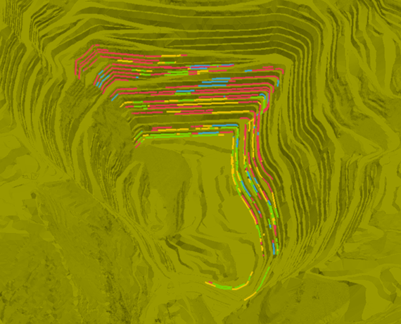
Identificación de inestabilidades con control estructural
Cargando 0%
Aris integra información de múltiples sensores, operación y modelos, ofreciendo vistas georreferenciadas y curvas de tendencia, para comprender rápidamente los riesgos geotécnicos que afectan la operación, apoyando una toma de decisiones oportuna
Aris simplifica el monitoreo geotécnico integrando en una única pantalla datos de sensores de distinto tipo y marca, complementado su análisis con información topográfica, estructural, de modelo geotécnico y de la operación. Su módulo de vigilancia apoya el seguimiento de variables críticas, alertando cuando se alejan del comportamiento configurado como normal.
Pero una parte importante de su funcionalidad es la capacidad de reaccionar automáticamente a estos cambios, lo que se convierte en una gran ventaja a la hora de solucionar posibles problemas o evitar consecuencias negativas.
Aris también brinda la capacidad de almacenar datos en un formato seguro y accesible para su uso posterior cuando sea necesario para análisis y planificación.
Aris utiliza tecnologías sofisticadas para combinar datos y analizarlos, creando una imagen completa de datos de diversas fuentes. Este sistema notifica sobre cambios críticos, permitiéndote reaccionar rápidamente ante ellos.
Aris está preparado para administrar información de distintos instrumentos, infraestructuras, sectores y condiciones geotécnicas, permitiendo evaluar de forma sencilla las variables de monitoreo conforme a las condiciones particulares de cada sitio
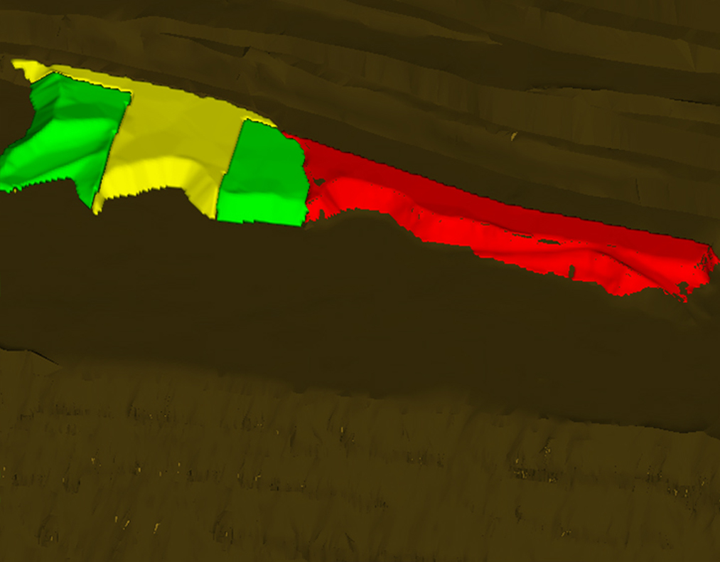
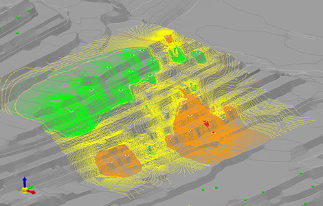
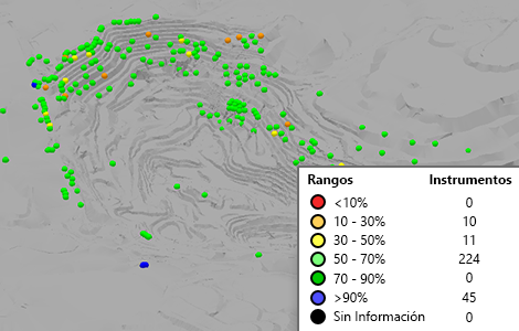
Con Aris es posible agrupar instrumentación y configurar los rangos de evaluación para múltiples variables por sensor, según las características geotécnicas particulares de cada sector; diferenciando así el monitoreo de unidades de rocas competentes, gravas no consolidadas, botaderos, pilas de lixiviación o muros de tranques de relaves, entre otras posibilidades
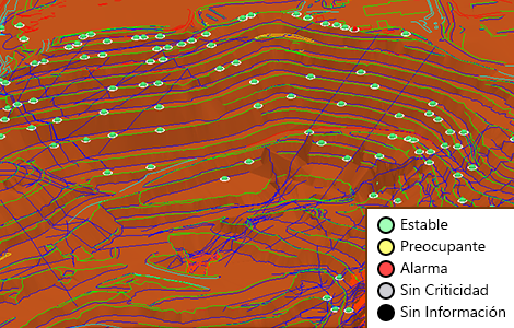
Entendiendo que una misma deformación no tiene igual impacto en diferentes rocas o tipos de material, Aris permite unificar la evaluación de criticidad de los diferentes sectores o unidades geotécnicas, mediante una escala (o semáforo) global que interpreta los rangos locales, traduciéndolos a una métrica general
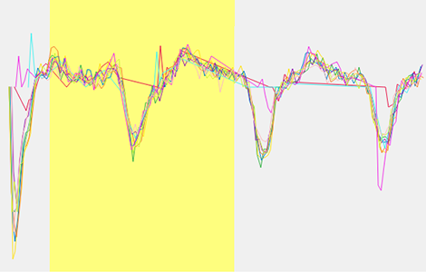
El módulo de vigilancia de Aris procesa de manera continua, según configuración del usuario, las lecturas que llegan al sistema, identificando ruidos y 3 niveles de criticidad (advertencia, alerta y alarma), enviando mensajes por pantalla y correo electrónico personalizado cuando el comportamiento observado traspasa los criterios definidos
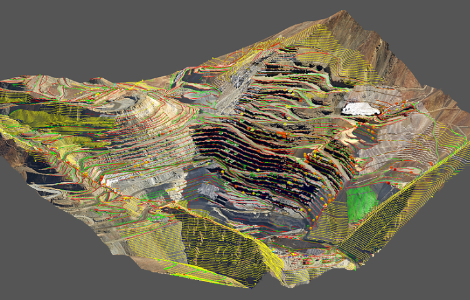
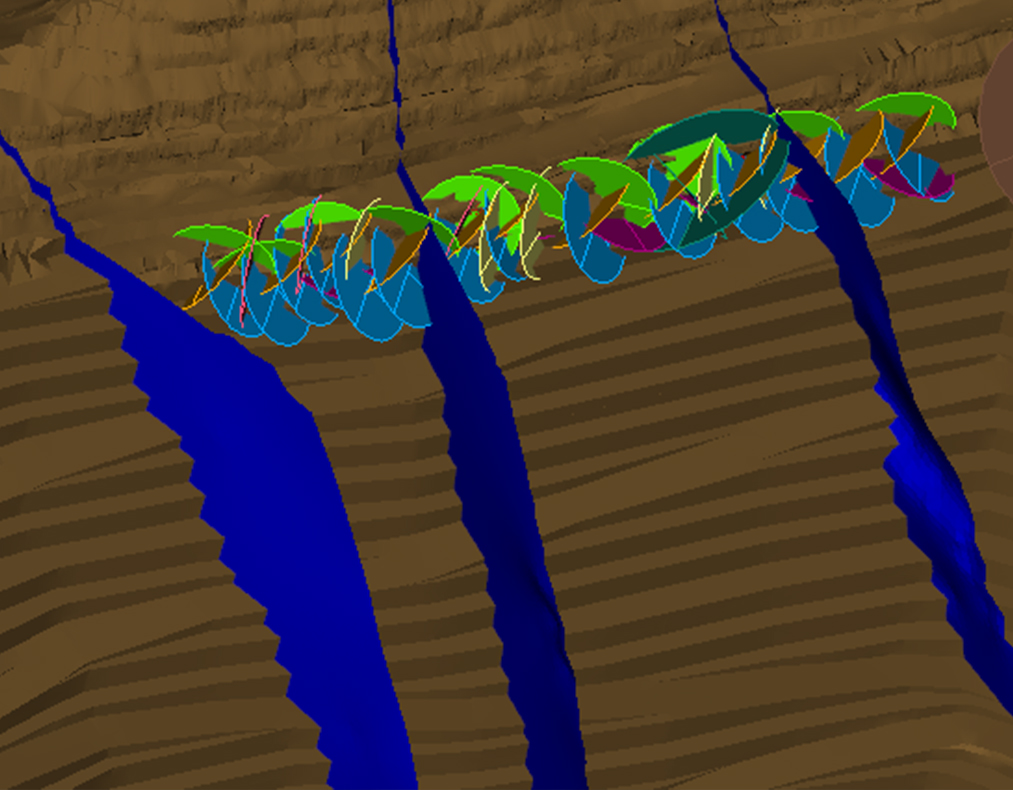
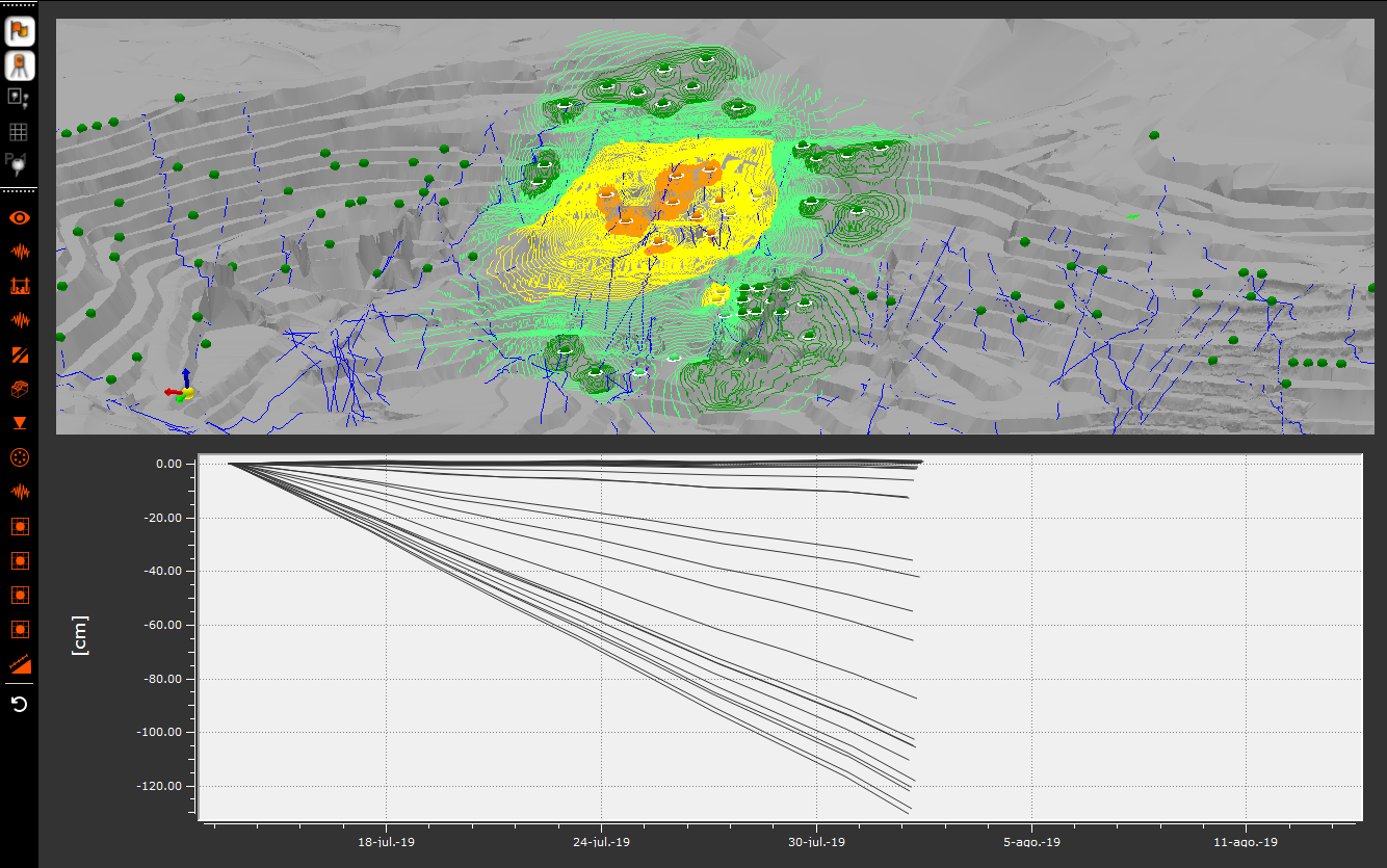
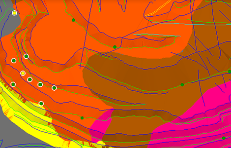
Junto al despliegue georreferenciado de las evaluaciones de mediciones instrumentales, Aris permite analizar la información mediantes isocurvas, vectores de desplazamiento, animación de trayectorias y gráficos de tendencias.
Mediante la correlación geográfica y temporal de eventos climáticos, sísmicos, operacionales e instrumentales registrados, se simplifica la interpretación de cambios de tendencias en las variables monitoreadas
Además, Aris visibiliza el estado de funcionamiento de los sensores, con variables como: días con lecturas, días desde la última lectura, disponibilidad del instrumento en el período, entre otras. Estas variables también son sujetas de vigilancia y pueden generar alertas en caso que los instrumentos no estén operando
Aparte del monitoreo y vigilancia en tiempo real, Aris administra en su base la información histórica de la instrumentación, ofreciendo una forma sencilla de consultar y analizar datos de cualquier período almacenado
Aris permite cargar datos de radares, estaciones totales (prismas), extensómetros, piezómetros, inclinómetros, acelerógrafos, insar, entre otros. En general, cualquier instrumento que exporte sus datos a un archivo de texto puede ser cargado.
En este momento, Aris integra datos de radares GroundProbe, Ibis y Reutech.
En este momento, Aris integra datos de estaciones Leica, Trimble, Topcon
No. Aris es un complemento para la integración del monitoreo, vigilancia y análisis geotécnico de la instrumentación.
En términos generales, Aris puede conectarse a bases de datos, directorios y archivos con información proveniente de diferentes tipos de dataloggers (por ejemplo: DT-2011, DT-2011B y DT-2055), o recuperados manualmente.
Aris no restringe ni limita el número de instrumentos que pueden ser incorporados a la plataforma; más bien, dependerá de la capacidad de almacenamiento del servidor en que sea instalado; lo que queda a criterio del cliente.
Además de la gran variedad de instrumentos que es posible integrar en Aris, en algunos casos es posible conectar los datos de sensores no soportados mediante un tipo de instrumento genérico.
En aquellos casos en que las mediciones son almacenadas por los instrumentos o los dataloggers, Aris recupera automáticamente las lecturas generadas durante el período en que no hubo comunicación una vez que es restituida.
Aris ha soportado el monitoreo y vigilancia de rajos (tajos), botaderos de estéril, pilas de lixiviación y tranques (presas) de relaves. No obstante, es posible considerar otras infraestructuras mineras o civiles que cuenten con instrumentación.
En general, a un servidor Aris pueden conectarse un número ilimitado de aplicaciones cliente (monitor). La restricción podría darse por las características del hardware donde se encuentra instalado el servidor y el ancho de banda disponible para la conexión cliente – servidor.
Revisa nuestras diferentes soluciones de data analytics y simulación que ayudan a tomar mejores decisiones en Planificación, Geotecnia, Excelencia Operacional, y Operaciones Mina
 ×
×