TIMining

    TIMining
    Geotech

    Geotechnical risk management: analyze, monitor and build with precision.

    Geotechnical suite for mining: proactive structural analysis, continuous monitoring, and slope construction control.

    GEOTECHNICAL INTELLIGENCE

    Transition from reactive to proactive geotechnics.

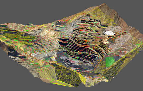
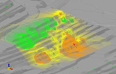
    Tangram detects, quantifies, and mitigates geotechnical risks by integrating structural mapping with development and design surveys in a high-precision 3D environment.

    Integrates mapped structures to locate unstable blocks, calculate tonnage, Safety Factor, and prioritize reinforcement.
    Tangram

    Analytical module that processes point clouds and fault information to model structural discontinuities and prevent rockfalls on operational benches.
    Tangram Overview

    1. Automatic and georeferenced detection of instabilities

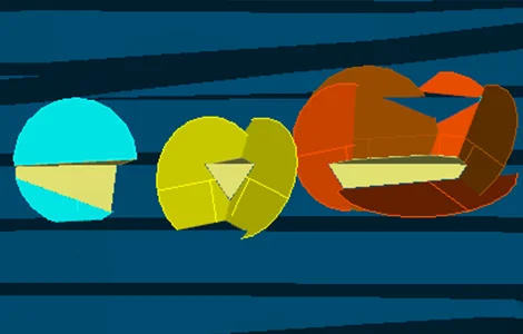
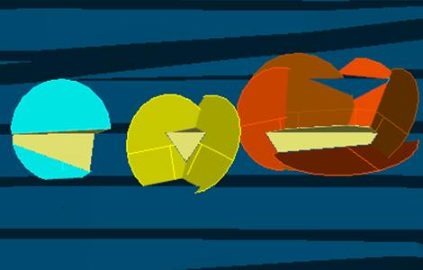
    Algorithmic identification of planar failures, wedges, and potentially hazardous blocks on exposed faces.
    Automatic detection

    2. Calculation of Safety Factor and Probability of Failure

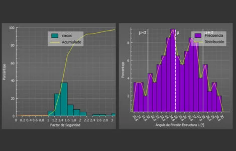
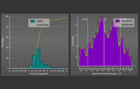
    Real-time geomechanical assessment for each unstable block quantified in the 3D model.
    Safety Factor

    3. Variation of design parameters and resulting topography

    Enables dynamic simulation of changes in face angles to mitigate risks before mining.

    Parameter variation

    4. Projection and simulation of structures

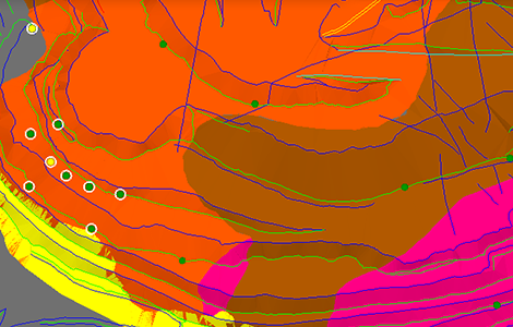
    Spatial extrapolation of structural planes into unexcavated areas or future expansion phases.
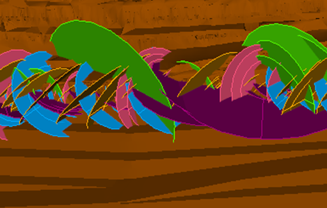
    Structure projection

    5. Mapping

    Direct and seamless loading of structural data and point clouds captured by scanners or drones.
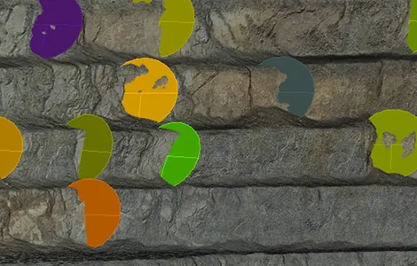
    Tangram Mapping

    6. Other featured tools

    Generation of standardized reports and interactive stereographic export in seconds.
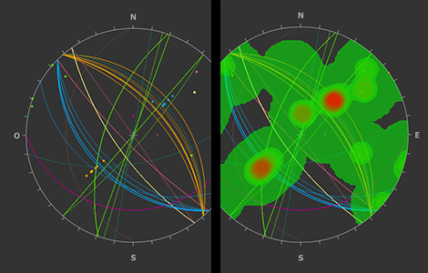
    Other Tangram tools
    • Proactive management and increased safety.
    • Time optimization and 3D interoperability.
    • Slope design support.
    • Management based on a structural database.
    Tangram Benefits
    • Automatic detection of planar failures, wedges, and complex blocks.
    • FoS and PoF calculation by block.
    • Simulation of structures toward design topographies.
    • Bulk attribute editing and seamless management of thousands of structures.
    Tangram Functionalities
    • Intel Core i7. Core i9 or higher recommended.
    • 16 GB RAM minimum. 32 GB or more recommended.
    • 500 GB storage. 1 TB or more recommended.
    • Windows 10 or higher.
    • Graphics card with OpenGL 3.3 support.
    Case 1 · Tier-1 copper mine

    Greater safety and operational continuity through automated instability detection.

    ~40% of unstable blocks identified early Average of 4 unstable blocks detected per month FoS · PoF calculated by block

    Early and georeferenced detection of instabilities on planned and constructed slopes. It is recommended to remove blocks with FoS ≤ 1.5 or PoF > 20% once the bench has been mined, increasing the reliability of the short-term plan.

    “By reducing geotechnical events, we increase operational continuity and the reliability of our plans.”

    Senior Geotechnical Engineer · Tier-1 copper mine
    Case 2 · Tier-1 copper and molybdenum mine

    Stability analysis in hours, not weeks.

    90% less analysis time (from one week to half a day) Automatic detection by structural domain

    Centralization of structural information (historical and new), automatic detection of georeferenced instabilities, and design evaluation to increase berm width in key areas.

    “The versatility of selecting structures for analysis by area allowed me to save a very significant amount of time.”

    Senior Geotechnical Engineer · Tier-1 mine

    GEOTECHNICAL MONITORING

    ARIS: continuous geotechnical monitoring for safer operations.

    ARIS centralizes data from multiple sensors on a single platform, delivers georeferenced 3D visualizations, and generates automatic alerts when parameters exceed defined thresholds in real time.

    Integrates information from sensors, operations, and models. Time-based navigation, geomechanical movement analysis, and rapid identification of geotechnical risks.

    ARIS

    Agnostic continuous monitoring platform that integrates with radars, prisms, and piezometers to unify the visualization of slope and tailings stability.

    ARIS Overview

    1. Instrumental data assessment by sector

    Intelligent filtering and analytical display according to the mine's zoning and critical infrastructure.

    Instrumental data

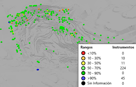
    2. Criticality assessment

    Instant risk categorization based on deformation acceleration trends.

    Criticality assessment

    3. Continuous monitoring

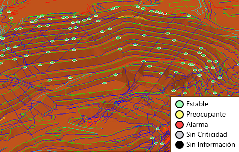
    Automated 24/7 processing on a unified server with an integrated risk traffic-light system.

    Continuous monitoring

    4. Visualization and analysis

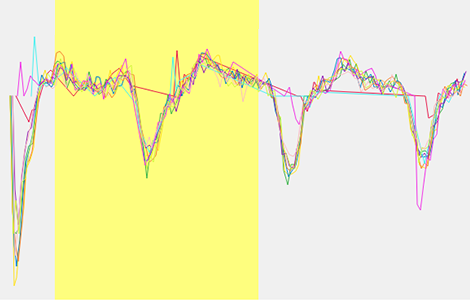
    Instant mathematical correlation between multiple instrumental variables within the 3D environment.

    Visualization and analysis

    5. Instrumentation status

    Comprehensive dashboard to verify the availability, battery level, and connection status of telemetry equipment.

    Instrumentation status

    6. Time management

    Time control bar for reviewing historical geomechanical evolution and mapping patterns.

    Time management
    • Integrated Information Management: Compatible with multiple brands and sensor types. Centralizes data on a single platform adaptable to any operation.
    • Automated Continuous Monitoring: Permanent assessment of critical areas. Immediate alerts. Traffic-light system for non-technical teams.
    • 3D Visualization with Time-Based Navigation: Combines sensor data with operational information for geotechnical risk analysis.
    • Infrastructure Integration: Centralizes monitoring of open pits, waste dumps, stockpiles, and tailings facilities.
    ARIS Value
    Accelerometers Extensometers Geophones Inclinometers InSAR Piezometers Total Station/Prisms Radar Seismographs TDR Weather Stations Drainage Systems
    24/7

    automated continuous monitoring of critical areas with immediate alerts and a traffic-light system.

    SLOPE CONTROL

    Precise control of slope construction for safer and more efficient mines.

    SICT automates geometric reconciliation between design and as-built data, revealing deviations that affect stability, costs, and safety.

    Combines real and design topography with geotechnical criteria on a centralized and collaborative base.

    SICT

    Analytical tool focused on mining quality assurance and quality control (QA/QC), ensuring that drilling and blasting operations comply with the final bench design.

    SICT Overview

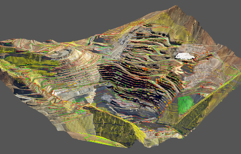
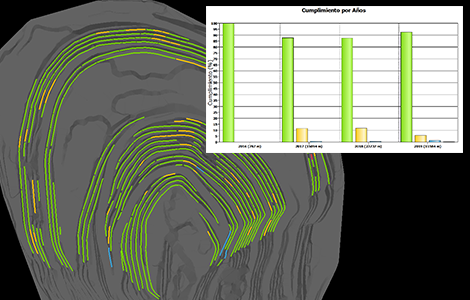
    1. Geometric reconciliation of slopes

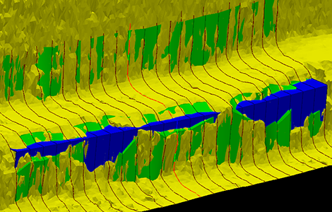
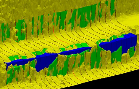
    Instant spatial audit of mined walls to control the geometric compliance of benches.

    Geometric reconciliation

    2. Slope construction process management

    Complete digital traceability and step-by-step collaborative validation between operations and geotechnical teams.

    Construction management

    3. Analysis using georeferenced historical information

    Analytical and comparative assessment against previous operational campaigns to optimize blasting.

    Historical information

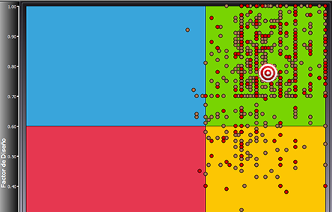
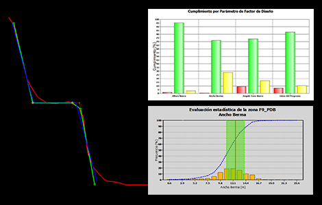
    4. Monitoring and control of slope design parameters

    Precise and continuous control of berm widths, crests, toes, and angle deviations.

    Design parameters

    5. Monitoring and control of slope geotechnical conditions

    Centralization of findings and structural anomalies directly within corporate mapping.

    Geotechnical condition

    6. Inter-ramp angle monitoring and control tool

    Large-scale monitoring that safeguards the overall stability of the main haul ramps.

    Inter-ramp angle

    7. Integration of 3D contextual information

    Integration of geological and topographic models into a single collaborative multi-user environment.

    SICT 3D Context
    • Automated geometric reconciliation in minutes.
    • Multi-parameter analysis of height, berm, angles, crest, and toe.
    • 3D visualization, metric charts, and detailed statistics.
    • Single, multi-user corporate database.
    SICT Values
    Case 1 · Tier-1 copper mine

    Improved slopes through deviation detection and best practices.

    +13% in berm width (from 6.27 m to 7.11 m) Automatic reconciliation of design vs. as-built

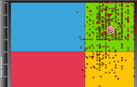
    Construction compliance control using Design Factor and Condition Factor. Collaboration between Geotechnical and Drilling & Blasting teams improved final wall control and the planned line.

    “Early detection of deviations in bench construction and their georeferenced visualization facilitated communication between the different areas.”

    Senior Geotechnical Engineer · Tier-1 copper mine