Preparation
- Preparation management and services
Some solutions reside within a stage; others run end to end.
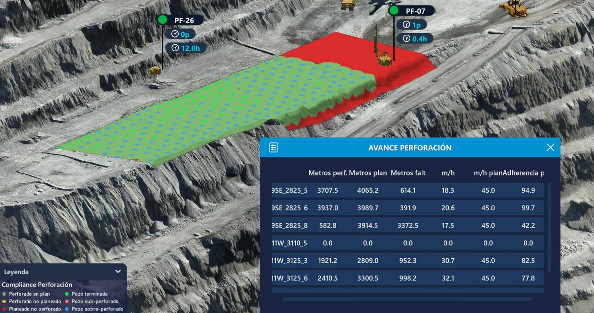
Tracks area-prep progress and drilling performance: holes, depth, collar deviation — plus fragmentation and blast quality against operating standards.
Visibility over the progress of auxiliary equipment in area preparation.
Performance control of drilling fleets and drilled holes (QA/QC).
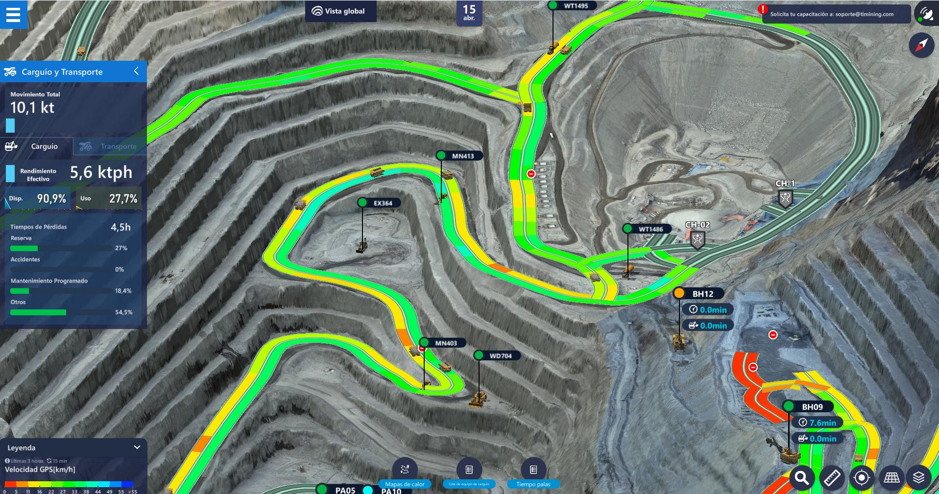
Reveals how the loading face, haul fleet, and routes are performing. Supports dispatch with continuous simulation and dynamic ETAs to sustain fleet speed and control operating cost.
Shovel performance: spotting and loading, floor control, and highwall scaling.
Continuous simulation and dynamic ETA calculations to prescribe tactics to dispatch or via API to the FMS.
Heat maps of road conditions (overload, chassis, tires) and geometry of dumping zones.
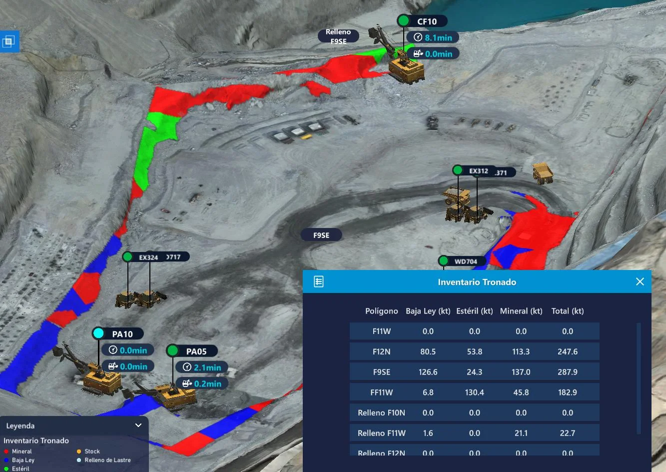
Gives visibility of material in motion and intermediate inventories, links mine to plant, and controls geometry and performance in waste-dumping areas.
Quality of intermediate inventories and monitoring of leach pads.
Machine-to-machine link between the mine’s ore flow and the plant.
Performance and geometry in waste dumping zones.
When a sequence deviation, a loss of traceability, or a geotechnical risk is detected at the end of the shift, it is already too late. These four capabilities make them visible as soon as they occur, throughout the entire value chain.
Closes the loop between execution and planning: incorporates the actual and historical performance of the site into the design of medium-term plans and anticipates non-compliance risks.
Scope: Entire operation
Allows viewing design and sequence deviations as soon as they occur, continuously auditing that execution respects the geometric design and planned spatial sequence.
Scope: Preparation → Extraction
Allows tracking ore traceability throughout the chain, managing its information flow (Ore Tracking) and ensuring the quality of intermediate inventories.
Scope: Drilling → Plant
Allows knowing instantly when equipment enters a geotechnical risk or exclusion zone, or a vertical interference occurs, and alerts about unsafe conditions on the digital map.
Scope: Entire operation
A unified ecosystem that evolves from descriptive visualization to prescriptive intelligence. TIMining CORE synchronizes plan intent with operational reality, detecting deviations and recommending corrective actions—all powered by AI.
Three products that operate on their own database, separate from CORE, covering the entire geotechnical management cycle.
Detects, quantifies, and mitigates geotechnical risks by integrating structural mapping with high-precision 3D topography.
Learn More About Tangram ARIS Geotechnical MonitoringCentralizes data from multiple sensors and generates automatic alerts when parameters exceed defined thresholds, in real time.
Learn More About ARISAutomates the geometric reconciliation between design and as-built conditions, revealing deviations that affect stability, costs, and safety.
Learn More About SICTBeyond the platform, our mining and data engineers transform real-time operational information into reports, studies, and solutions tailored to each mine's business rules.
Specialized operational studies and analyses—from operational performance to scenario planning and specific technical studies—to answer critical operational questions with evidence from real-time operational data.
Regular reporting with key operational indicators, ready for decision-making and shift handover.
Customized development for specific mine challenges.
We adapt our solutions to the complexity and business rules of each mine.